background piture shows a train station where many people walk around

What's
NavCog?

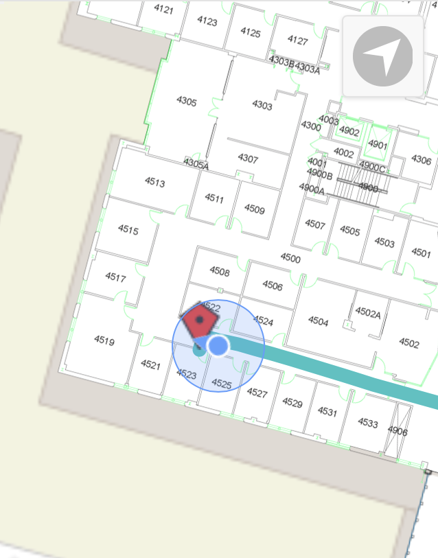
NavCog is an iPhone app for indoor navigation, aimed specifically to help people with visual impairments explore the world without vision. This is also helpful for people who are not familiar with inside buildings and at huge and complex places such as universiry, airport, and hospital.

NavCog is open-sourced as a part of Hulop project. Also, you can download our app from App Store. We have several areas where you could try.

VIDEO

We implemented NavCog at the hotel where the conference was held. Not only in 2017 but also in 2018, the conference was held at the same hotel and we have continued supporting the attendees.

HOW TO
USE

1. Enter your destination

thr screenshot of smartphone choosing a destination

Select your destination by using voice search or an index

2. Follow navigation

thr screenshot of smartphone navigating a user

Until arriving destination, NavCog provides turn-by-turn audio feedback

LOCATIONS

READY on App Store

  • Pittsburgh International Airport - Pittsburgh
  • Carnegie Mellon University - Pittsburgh
  • Double Tree by Hilton Hotel Green tree - Pittsburgh
  • Shimizu Corporation HQ - Japan

Pilot Study

  • Nihonbashi Muromachi Area (COREDO Muromachi) - Japan
  • Narita International Airport - Japan
  • Toyosu Civic Center - Japan
    (Inclusive Navi developed on top of Hulop)
  • Allegheny General Hospital - Pittsburgh
  • The Andy Warhol Museum - Pittburgh

SYSTEM

NavCog is an indoor navigation system, which achieves accurate localization using a novel algorithm which combines Bluetooth Low Energy (BLE) Beacons with smartphone sensors.

4 STEPS to install

  1. Deploy and manage beacons
  2. Sample beacon data
  3. Generate topology map
  4. Add accessibility info and point of interests
the overview of system