|
Localization is the problem of how Minerva determines her position in the
environment. The problem is relatively easy in static environments, or
if the environment is equipped with special-purpose localization
equipment (such as radio beacons). Minerva's environment, however, is
densely populated, and is not modified in any way to facilitate
navigation. Thus, Minerva must rely on the natural features of her
environment to localize itself.
Minerva maintains a sense of orientation using a high-resolution
Markov localization algorithm. Markov localization represents beliefs
using probability distributions, enabling her to handle ambiguities and
recover gracefully from sensor errors. This module periodically
compares camera images and laser range scans with Minerva's ceiling map and the occupancy map. A unique feature of Minerva's
localization component is a filter for identifying sensor data
corrupted by people--an essential component for successful navigation
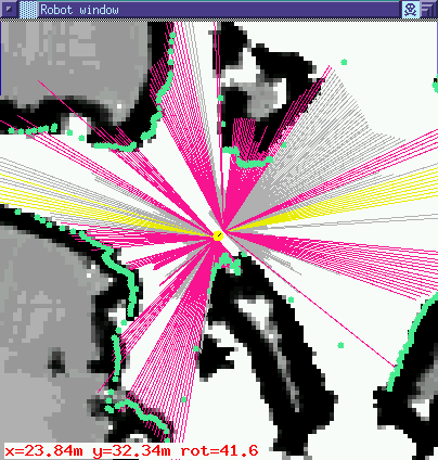
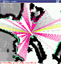
in populated environments. Below is a typical example of a range
scan, projected into the occupancy map at the most likely position:
More information on Minerva's localization module can be found in the
following papers:
- D. Fox, W. Burgard, and S. Thrun. Active Markov Localization for Mobile Robots,
accepted for publication in: Robotics and Autonomous Systems (special issue Euromicro'97), to appear.
- D. Fox, W. Burgard, S. Thrun, and A.B. Cremers. Position
Estimation for Mobile Robots in Dynamic Environments,in: Proceedings of the Fifteenth National Conference on
Artificial Intelligence (AAAI'98),
Madison, Wisconsin, 1998.
-
M. Beetz, W. Burgard, D. Fox, and A.B. Cremers. Integrating
Active Localization into High-level Robot Control Systems, in:
Robotics and Atutonomous Systems (special issue SIRS'97), to appear.
-
W. Burgard, D. Fox, and S. Thrun. Active
Mobile Robot Localization , Proceedings of the Fifteenth International
Joint Conference on Artificial Intelligence (IJCAI'97),
Nagoya, Japan 1997.
-
W. Burgard, D. Fox, and D.
Hennig. Fast
Grid-based Position Tracking for Mobile Robots, in: Proceedings
of the 21th German Conference on Artificial Intelligence (KI
97), Freiburg, Germany, Lecture Notes in AI 1303, 1997.
-
W. Burgard, D. Fox, D.
Hennig, and T.
Schmidt. Estimating
the Absolute Position of a Mobile Robot Using Position Probability Grids,
Proceedings of the Thirteenth National Conference on Artificial Intelligence
(AAAI-96).
|